A FOUNDATION MAP OF THE CARTOGRAPHY OF CANADA
Guillaume DeL’Isle - Canada
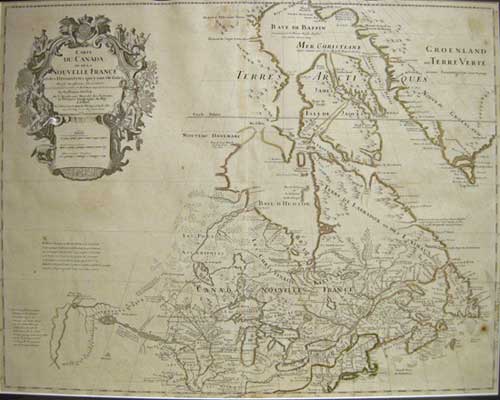
CARTE DU CANADA ou del la NOUVELLE FRANCE et des Decouveres qui y ont été faites.
Fifth State, Chez l'Auteur sur le Quai de Hologe a la'Aigle d Or. Paris 1703 [1718]
Original hand coloured copper engraved map being the fifth known state of the plate with the imprint as above. decorative cartouche. mileage scales.
19 5/8 x 25 ½" (50 x 65.5 cm.) PRICE CODE E
Ref. PdeA1/SLN/ r.anda > DLNN
This is one if the classic maps of Canadian Cartography and highly desirable for anyone starting a collection of maps pertaining to Canada or exploration of the Arctic.
Depicted is what was the known territory of Canada at the beginning of the 18th cent. from south of the Great Lakes east to Newfoundland, North to Baffin bay, Greenland apparently still firmly attached to the mainland with the three island concept of Baffin Is., in evidence, and west to the Lahontan Lakes and mythical 'Great river of the West'. Like all great maps of Canada this one shows the location of Port Hope, the early native settlement of Gandarasqué. Del' Isle is listed in the title cartouche as Premier Gergraphe de Roi, an honorary position especially created for him.This map was first issued by Guillaume Delisle in 1703, the cartouche still bears that date, this important, detailed map provides the most accurate rendering of the Great Lakes of the time, with the lakes fully enclosed and properly placed in the beginnings of more accurate knowledge longitude and latitude.
Home | Contact | Location | Links | Antique Prints | Fine Art | Antique Maps | Omnium Gatherum | Specialty Services
