
HOMANN -WESTERN HEMISPHERE
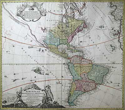
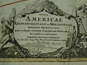
Totius AMERICAE Septentrionalis et Meridionalis Novissima Repræsentatio quam ex singulis recentium Geographorum Tabulis collecta luci publicæ accommodavit.
Johannes Baptista Homann Nurenberg Undated [ca.1720-37]
Copper plate engraved map on M.H.D. watermarked laid paper. Original hand tinted body colour with un-tinted (as issued) decorative title cartouche and another (top left) notation on the discovery of America and its religion. Center fold and minor colour offseting and creasing.
19 3/16 x 22 1/2" (48.5 x 57.2 cm) Ref. BR1(181)/SLN/l.ando>DELN PRICE CODE E
Johann Baptiste Homann's decorative map of America, the first of two maps of America published by the Homann family. ‘Cum Privulegio Sac. Cæs. Majestatis’ in their Neuer Atlas.
A large, richly engraved and un tinted (as issued) title cartouche shows traditionally dressed indigenous peoples of both hemispheres, together with three indigenous animals. As well as European colonists proffering trade goods to a group of natives and a five windmill village vignette of a New World settlement. After J. B. Homann died 1724, his son Johann Christoph, re-engraved the plate to correct the western coastline of North America, shown here extending to the far west and north. This is the second state of the map, which includes a long northwest coast of America, named Terra Esonis Incognita which bears the notation ”Costa Terrae Borealis incognitae detecta a Dom: Ioanne de Gama navigante ex China in Novam Hispaniam."California is now attached to the mainland, correcting the earlier states of the map. The prominent remnants of the interior sea, aka ‘Great sea of the west’, can be seen near the Pays de Moozemleck. its delineation marks the boundary of known, as opposed to unknown, territory. The Great Lakes still have an early delineation. There is a wealth of detail within the map, especially in the southwest and near the Great Lakes, which were then actively being explored by the French fur traders and Hudson's Bay Company. Topographical features, rivers, indigenous tribal areas, trading posts, missions and forts are delineated some of which are also dated.
Home | Contact | Location | Links | Antique Prints | Fine Art | Antique Maps | Omnium Gatherum | Specialty Services
