WALKER War of 1812
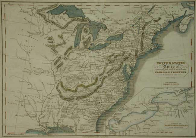
UNITED STATES OF AMERICA exhibiting the seat of war on the CANADIAN FRONTIER from 1812 -1815
inset : Chart of LAKES ERIE & ONTARIO on an enlarged scale
R. Walker engraver. Edw. Baines, Leeds, 1816
SCARCE Hand coloured, Copper engraved map Scale bars
9 1/2 x 13 1/2” ( 24.1 x 34.3 cm.)
This scarce map was engraved by R. Walker, of whom we can find no trace. Published by Edward Baines, Leeds. August 5th. 1816 it depicts from the mouth of the Mississippi west to the Pawnee territory in Louisiana, north to Lake Superior and Lake Iskaskagamagts and the eastern Atlantic coastline. Rivers, Lakes, mountain ranges, early existing states, Indian tribal areas, major and minor towns, are named in both US and Canada. As are the immense forests along the Ottawa river.
The inset shows the principle battleground area around lakes Ontario and Erie, showing military roads and forts, principle towns engaged in the conflict. This is a most useful map or those interested in the War of 1812. The map is similar to another published by J. Talbot.
Home | Contact | Location | Links | Antique Prints | Fine Art | Antique Maps | Omnium Gatherum | Specialty Services
