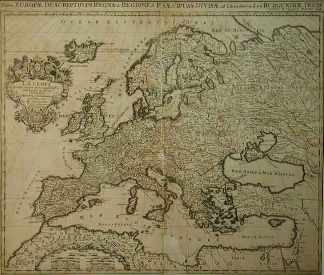
Nova Europæ Descriptio, in Regna & Regiones Præcipuas Divisæ, ad usem serenissimi Burgundiæ
Hubert Jaillot, Paris 1696
Cartouche with French title “L’Europe divisee en ses principaux estats....” outline colour. some professional repairs but surface loss along center fold. nine scale bars.
19 3/8 x 231/4” (49.2 x 59 cm.)
Ref. PS14 /DLN/ s.nl > LOL
Depicts the continent of Europe, from Icelnd to White Russia and the African Mediterranian coastline. Topographical features, along with political boundaries and many towns are delineated. Published in Jaillot’s Atlas Nouveau.
Alexis Hubert Jaillot 1632-1712 was a French sculptor who became enamoured of his father in law’s study of cartography. He succeeded the Sanson family as the most influential producer of french maps. Appointed Géogrphe du Roi to Louis XIV in 1678, of his 15 children two others became Royal Geographers.
despite it’s condition this is a valuable starter map for a budding collector.
Home | Contact | Location | Links | Antique Prints | Fine Art | Antique Maps | Omnium Gatherum | Specialty Services
