Since 1763 the name 'Russborough' has been synonymous with collecting and dealing in fine art. In the closing decades of the last century the historic town of Port Hope has become home to Lord Russborough's Annex, which specialises in an individual mix of antique maps, paintings and prints.

While Lord Russborough's Annex features a great many works of museum calibre, we also offer a wonderful selection of prints priced at under $100.

European Maps

An extract of our Antique Maps:
1600-1699 1 2 3

1700-1799 1 2 3

Antique map index

Maps of Europe from the
seventeenth century

DESCRIPTION

PRICE CODE

Click here for full description

Mercator Jansson White Russia 1635

Mercator/Jansson White Russia

Moscovia Russia cum consinijs [sic].
[Amsterdam] 1635

5 5/8 x 7 3/4” (13 x 19.8 cm.) Uncoloured as issued.

Ref.PS21/DNN/s.nl> RDN


SOLD
B

Click Here
for Pricing Details

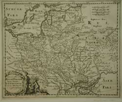
Click here for full descriptionCluver poland Lith 1697

Cluver  Poland Lithuania

Vetris et Novæ Regni Poloniæ magniq ducatus Lithuaniæ...

Philip Cluver 1697

8 3/4 x 11 1/8” (22.3 x  28.2 cm.) Uncoloured as issued.

Ref.PS20/ANN/s.nl> EAL

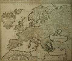
Click here for full descriptionJaillot Europe 1696

JAILLOT  EUROPE

Nova Europæ Descriptio, in Regna & Regiones Præcipuas Divisæ, ad usem serenissimi Burgundiæ

Hubert Jaillot, Paris 1696

19 3/8 x 23 1/4”  (49.2 x 59 cm.)

Ref. PS14 /DLN/ s.nl > LOL 

Maps of Europe from the
eighteenth century

DESCRIPTION

PRICE CODE

Click here for full description

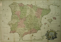
            Senex Spain full

Senex Spain and Portugal

A Correct Map of Spain & Portugal according to the newest observations ...... Queen. [London 1708 -1714]

Copperplate engraved  map with original hand full body colour. Ornate title cartouche (bottom right), incprporating putti figures. Some discolouration along lower folds.  24 5/8 x 36 1/2 (62.5  x 92.7 cm.)

Ref. DB 4 /RLN /a.sn > SLN


SOLD
D
Click Here
for Pricing Details

Click here for full description

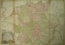
Senex Germany full C


John SENEX   GERMANY

GERMANY Corrected from the observations  of the Royal Society at London and the Royal Academy at Paris by John Senex FRS. 1710 Iohan Senex sculpt.

25 1/2 x 37 5/8”  (64.8 x 95.6 cm)

Copperplate engraved map with original hand full body colour. Ornate title cartouche (Bottom Left) incprporating allegorical human and putti figures. (tinting of title cartouche by another hand.) Some browning and separation along one fold.

Ref. DB 5 /RLN /a.sn > SLN  

SOLD
D
Click Here
for Pricing Details

TOP

Maps of Europe from the
eighteenth century

DESCRIPTION

PRICE CODE

Seutter ukraine & Crimea

            Click here for full description

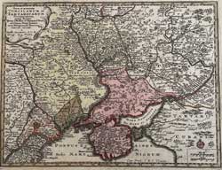
Matthias SEUTTER

UKRAINE AND CRIMEA

Nova et accurata /Turcicarum et/ Tartaricarum/ Provinciarum/ intra fluvios/ Tyras, S Niester et Tanaim S. Don/ ad Oram Ponti Euxini/ et in Peloponneso Taurica/
[Augsburg 1744 ] 7 ¾ x10” (19.7 x 25.3 cm.)

Ref. BD 6(50)/ANN/ r.anaa > LNN

SOLD
C
Click Here
for Pricing Details

TOP