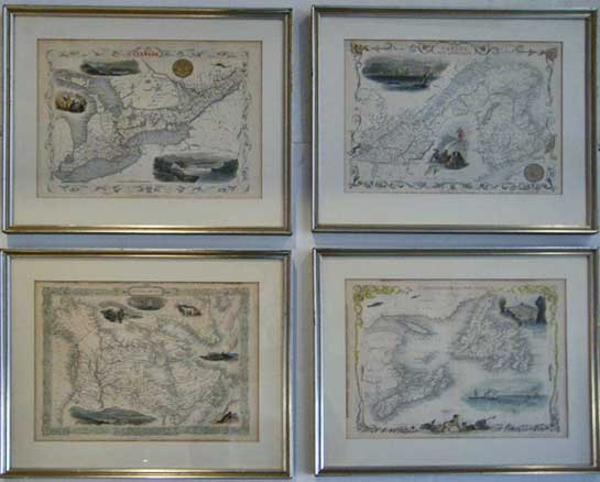
British America. Vignette of Boston
West Canada. Vignette of Kingston
East Canada and New Brunswick. Vignette of Quebec
Newfoundland and Nova Scotia. Vignette of St. Johns
Hand tinted steel engraved maps, decorative vignettes, Scale bar, Matted, Glazed, Silver-gilt wood frames
Maps: Approx 10 x 13" (25.1 x 32.4 cm.) Frames: 14 7/8 x 17 7/8"
Set of Four engraved maps Ref. LRAM1295/ELN/d.andl> DLNN CLICK HERE FOR PRICE GUIDE
John Tallis and Company published views, maps and Atlases in London from roughly 1838 to 1851. The principal works, expanding upon the earlier works of Cary and Arrowsmith, include an 1838 collection of London Street Views and the 1849 The British Colonies; Their History, Extent, Condition and Resources. Edited by R. Montgomery Martin also the Illustrated Atlas of the World London 1851, which was issued to coincide with the Great Exhibition in London 1851.His principal engraver was John Rapkin (ƒl.1845 – 1851), whose name and decorative vignettes appear on most Tallis & Co. maps. Due to the decorative style of Rapkin's work, many regard Tallis maps as the last bastion of English decorative cartography in the 19th century.
The London Printing and publishing Company of London and New York bought the rights for many Tallis maps in 1850 and continued publishing his Illustrated Atlas of the World until the mid 1850s. Specific Tallis maps later appeared in innumerable mid to late 19th century publications as illustrations and appendices.
The Bristol Times observed that Mr. Tallis maps "are not only critically correct, but are accompanied with elegant and appropriate engravings illustrative of the manners and costumes of the different countries."

Tallis British America 1849 detail


