Since 1763 the name 'Russborough' has been synonymous with collecting and dealing in fine art. In the closing decades of the last century the historic town of Port Hope has become home to Lord Russborough's Annex, which specialises in an individual mix of antique maps, paintings and prints.

An extract of our prints currently available:
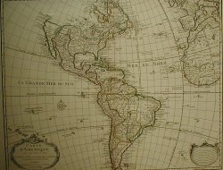
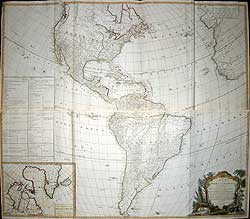
De L'Isle - Western Hemisphere
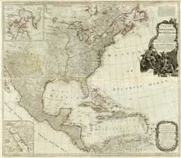
Pownall/Gibson/Bowen- North America
D'Anville /Pownall-Americas
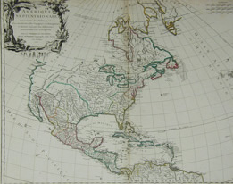
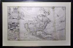
Robert De Vaugondy - North America
Tobias Conrad Lotter - North America
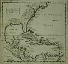
Moll West Indies & Florida
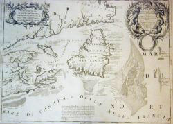
Coronelli - Eastern Canada
Moll - North America The Cod Fishery Map
Langlois E-H. Mexican Texas
|
||||||||||||||||||

|
||||||||||||||||||
|
||||||||||||||||||

![]()
Lord Russborough's Annex, 82 Walton Street, Port Hope, Ontario, Canada L1A 1N3
Home | Contact | Location | Links | Antique
Prints | Fine Art | Antique
Maps | Omnium Gatherum | Services
Glasswork and Jewellery Designer Chris Montgomery: The
Glasshopper | Her Ladyship's Bijouterie