Since 1763 the name 'Russborough' has been synonymous with collecting and dealing in fine art. In the closing decades of the last century the historic town of Port Hope has become home to Lord Russborough's Annex, which specialises in an individual mix of antique maps, paintings and prints.

Antique maps Index

An index of our Maps currently available:

World & Western Hemisphere: 1  2 3 4 5 6 7 8
Arctic Regions:  1 2 3 4
North America: 1  2 3 4 5 6
Canada and Great Lakes1 2 3 4 5 6 7 8 9 10 11  12 13 14 15 16 17 18 19 20 21 22

Europe:1 2 3 4 5
British Isles: 1 2 3 4 5
Asia: 1 2 3
Celestial Charts: 1 2

An extract of our rare antique maps pertaining to Western Hemisphere, and the World:


DESCRIPTION

PRICE CODE

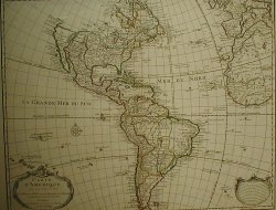
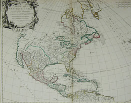
De L'Isle - Western Hemisphere

De L'Isle - Western Hemisphere

A FOUNDATION MAP OF THE CARTOGRAPHY OF THE AMERICAS

CARTE D'AMERICA
Guillaume De L'Isle, Paris 1722.
State II. Original colour,
19 1/4 x 24 1/4" (48.7 x 61.2cm.)

RefWH19 D685/DLN/dn.sd ARNN

SOLD
F
Click Here
for Pricing Details

Seile western hemisphere

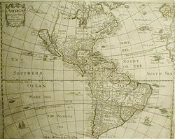
Henry Seile - Western Hemisphere

CALIFORNIA AS AN ISLAND
AMERICÆ
Descriptio Nova Impensis Henrici Seile

Henry Seile, [London ] 1652. First issue,
13 1/4 x 16 1/2" (34 x 42 cm.)

Ref. M913 WA15/ALN/v.sa DSLN


SOLD
F
Click Here
for Pricing Details

Homann Americas

Homann J.B.-Western Hemisphere

Totius AMERICAE Septentrionalis et Meridionalis Novissima Repræsentatio

Johannes Baptista Homann      Nurenberg  Undated [ca.1720-37]
19 3/16 x 22 1/2" (48.5 x 57.2 cm) Ref. BR1(181)/SLN/l.ando>DELN

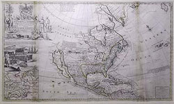
Moll Cod Fish Map

MOLL   NORTH AMERICA

This Map of  NORTH AMERICA according to the newest and most exact observations.

Hermann Moll London  Ca. 1720
Ref. PR1/LNNN / g.ando> VLNN     PRICE CODE  I


DESCRIPTION

PRICE CODE

Robert De Vaugondy - North America

Robert De Vaugondy- North America

A CLASSIC MAP FROM THE GOLDEN AGE OF FRENCH CARTOGRAPHY

AMÉRIQUE SEPTENTRIONALE
Didier Robert de Vaugondy, Paris 1750 [1757-8].
Original outline colour,
18 3/4 x 23" (47.8 X 58.2 cm.)

Ref.NA15 M818/ENN/rsa ADVL


F
Click Here
for Pricing Details

lotter_north_america

Tobias Conrad Lotter - North America

THE FIRST DEPICTION OF THE SARAGASSO SEA
AMERICA SEPTENTRIONALIS

Tobias Conrad Lotter. Augsberg (1778), Original colour,
18 x 22 3/4" (46 x 57.8 cm.)

Ref. M952/ROG/l.anna DSOL


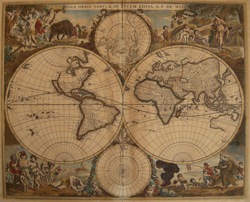
de wit world small

De Wit - Double Hemisphere Map of the World

NOVA ORBIS TABULA IN LUCEM EDITA  A. F. De WIT.

Frederick De Wit. Amsterdam (Ca 1680) Original colour,decorative corner vignettes & border.
18 13/16 x 22 1/2" (47.9 x 57.2 cm.)


Ref. LRA 1289/ANN/l.andr LONN

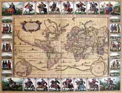
Visscher World Sm

Claes Janszoon Visscher The Twelve Caesars Map

NOVA TOTIUS TERRARUM ORBIS GEOGRAPHICA AC HYDROGRAPHICA TABULA Autore N. I. Piscator
Claes Janszoon Visscher Amsterdam 1639 (1652)

 Ref. LRA 1290/ANN/ g.andr >ANLNN
Price code L

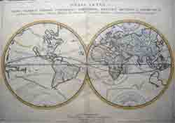
sanson world sm

Sanson World

ORBIS VETUS, et ORBIS VETERIS UTRAQUE CONTINENS, TERRAURMq TRACTUS ARCTICUS, et ANTARCTIUS ex Platone ...

Nicholas Sanson Paris 1657

14 7/8 x 21"   (37.8 x 52.3cm )

Ref. BD4/ALNN/ v.anno >RANN Price code F SOLD

Visscher World Sm

Claes Janszoon Visscher The Twelve Caesars Map

NOVA TOTIUS TERRARUM ORBIS GEOGRAPHICA AC HYDROGRAPHICA TABULA Autore N. I. Piscator
Claes Janszoon Visscher Amsterdam 1639 (1652)

 Ref. LRA 1290/ANN/ g.andr >ANLNN
Price code L